Travel Map of Thiruvananthapuram District in Kerala
Thiruvananthapuram District Map, Kerala District Map with important places of Thiruvananthapuram
Map of Thiruvananthapuram district with important places
Like This? Please Share it!
Thiruvananthapuram District Map: Travel Map of 
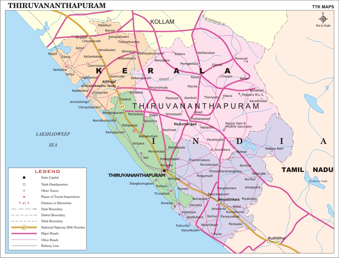
Thiruvananthapuram District
Travel Map of Thiruvananthapuram District in Kerala with district headquarters, taluk headquarters, towns, places of tourist importance, distance in kilometers (km), district boundary, taluk boundary, national highway with number, major roads, other roads, railway line.
Tweet
Share
Link
Share
Class
Send
Send
KERALA TRAVEL MAPS
- Alappuzha
- Ernakulam
- Idukki
- Kannur
- Kasaragod
- Kollam
- Kottayam
- Kozhikode
- Malappuram
- Palakkad
- Pathanamthitta
- Thiruvananthapuram
- Thrissur
- Wayanad
INDIA CITY MAPS
- Ahmadabad
- Bangalore
- Chennai
- Coimbatore
- Delhi
- Hyderabad/Secunderabad
- Kochi
- Kolkata
- Mumbai
- Pondicherry
- Pune
- Surat
INDIA REGIONAL MAPS
- Andhra/Telangana Travel Map
- Bihar Travel Map
- Goa Travel Map
- Gujarat Travel Map
- Haryana Travel Map
- Himachal Pradesh Map
- Karnataka Travel Map
- Kerala Travel Map
- Maharashtra Travel Map
- Punjab Travel Map
- Rajasthan Travel Map
- Sikkim Travel Map
- Tamil Nadu Travel Map
- Uttar Pradesh Travel Map
- West Bengal Travel Map