West Bengal Travel Map
Cultural capital with Darjeeling tea gardens, Sundarbans, and colonial heritage
Interactive State Map
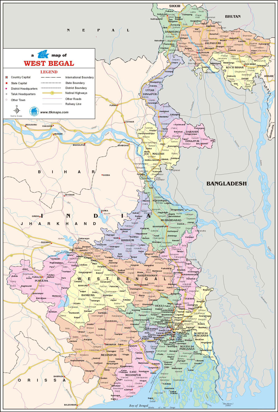
West Bengal State
Comprehensive travel map showing state capital, district headquarters, taluk boundaries, tourist places, national highways, and railway networks.
Major Tourist Attractions
Top Places to Visit: Darjeeling, Sundarbans, Kolkata Victoria Memorial, Digha Beach, Kalimpong
Travel Tip: The best time to visit West Bengal is during October to March when the weather is most pleasant for sightseeing.
Map Features
Road Networks
National highways, state highways, and major road routes
Railway Lines
Major railway stations and train routes
Cities & Towns
All major cities, district headquarters, and taluk centers
Tourist Places
Popular destinations and points of interest
Explore Nearby States
India Regional Maps
Discover tourist destinations across Indian states