Sikkim Travel Map
Himalayan jewel with stunning mountain views, monasteries, and pristine nature
Interactive State Map
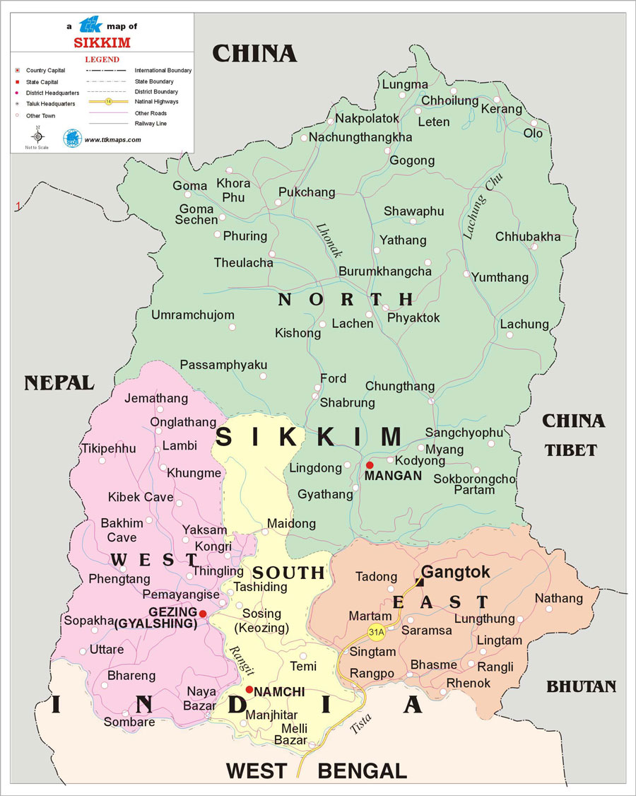
Sikkim State
Comprehensive travel map showing state capital, district headquarters, taluk boundaries, tourist places, national highways, and railway networks.
Major Tourist Attractions
Top Places to Visit: Gangtok, Tsomgo Lake, Nathula Pass, Pelling, Rumtek Monastery, Yumthang Valley
Travel Tip: The best time to visit Sikkim is during March to June, September to December when the weather is most pleasant for sightseeing.
Map Features
Road Networks
National highways, state highways, and major road routes
Railway Lines
Major railway stations and train routes
Cities & Towns
All major cities, district headquarters, and taluk centers
Tourist Places
Popular destinations and points of interest
Explore Nearby States
India Regional Maps
Discover tourist destinations across Indian states